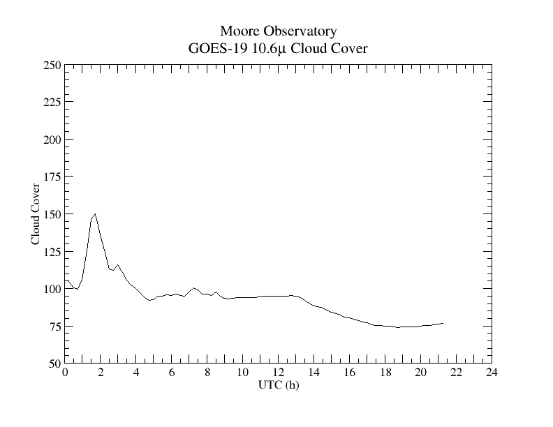
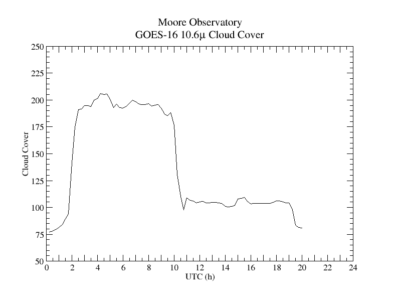
GOES-16 infrared (10.3 μm ) line-of-sight emission from the area of Moore Observatory

The data and image are from the NOAO GOES-16 geosynchronous satellite, also known as GOES-East. The plot is derived from the image data maintained by the Space Science and Engineering Center of the University of Wisconsin and is updated every 15 minutes. The image is the most recent one from NOAA for our region.
This spectral region is part of the spectrum where the Earth's surface cools by radiating most of its thermal emission back into space, and this narrow band is free of absorption by molecules in the atmosphere. The thermal signal is strongest in the absence of clouds and measures the line of sight temperature. By inverting the scale, the image and data show the atmospheric transparency through the line of sight from Earth's surface to GOES-16. White or higher values are a consequence of intervening clouds.
Last update: November 9, 2022
John Kielkopf